


W0C/FR-076
Evergreen Mountain
2602 m / 8436 ft
Nov 29, 2014
By KX0R
Evergreen Mountain is a classic, easy 2-point SOTA peak west of Denver.
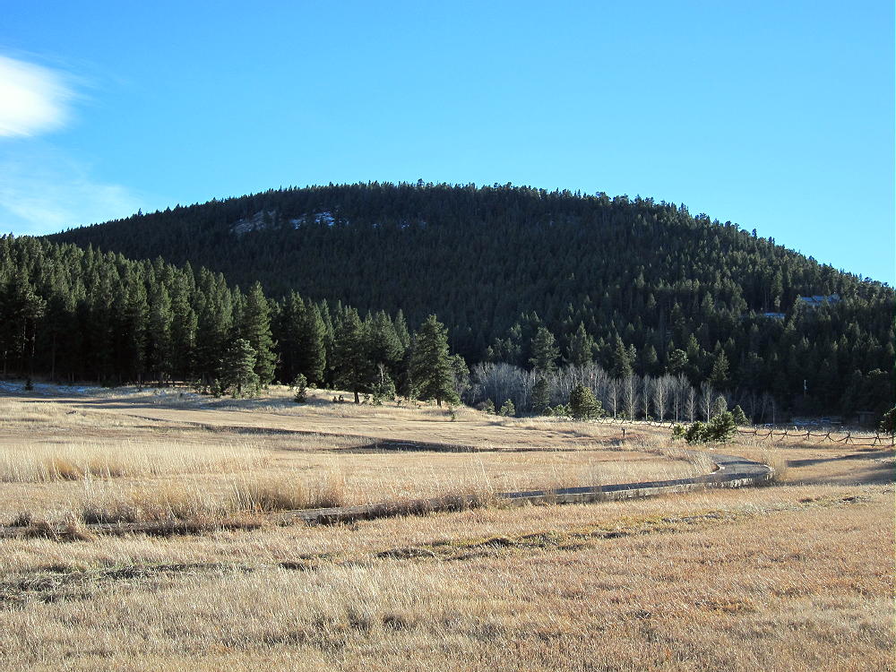
Evergreen Mountain from near Trailhead
Here’s how to get to the trailhead and the summit:
1) Drive to Morrison via W-470
2) Exit and follow paved highway 74 west through Morrison and up Bear Creek Canyon
3) Drive about 15 winding miles to Evergreen
4) At a traffic light in Evergreen, just east of Evergreen Lake, turn left, south, on highway 73 – this is marked as “to highway 285”.
5) Drive south about 0.4 mile and turn right on paved Buffalo Park Road, road 89
6) Drive west and climb about 2-1/2 miles up to the Alderfer/Three Sisters Jefferson County Open Space Park
7) Pass the east parking lot for the Park, climb up a hill, and drive past the Alderfer Barn on the right. Turn right after the Barn at a marked corner, and park in the west parking lot. Everything is free.
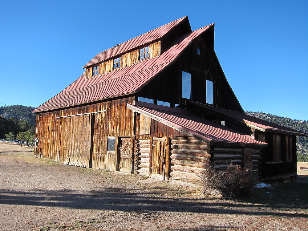
Alderfer Barn
8) There are convenient facilities and park maps at the trailhead. Please read and obey the rules – this is a really nice place!
9) Evergreen Mountain is visible to the south. There are some houses around the mountain, but most of the land is in the Park. Follow the obvious trail south across the highway, hike around the Wild Iris Meadow, and climb Evergreen Mountain via the Evergreen Mountain West trail. There are signs at key junctions.
10) The trail has a gentle grade and is used by mountain bikers as well as hikers. This peak offers an ideal bike SOTA. The hike is easy, but it’s over 2 miles to the summit, because of the many switchbacks. The trail goes right to the top, and there is a scenic loop around the west side.
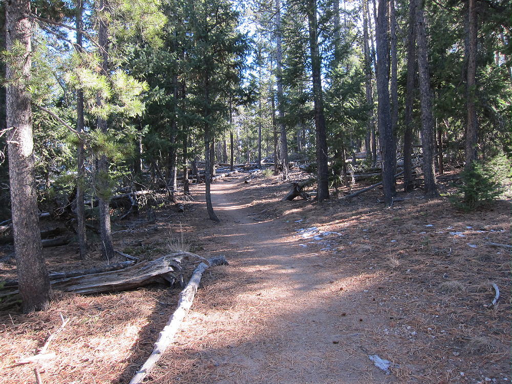
Evergreen Mountain Trail near Summit
There is no water along the route, so be sure to bring water. The trail goes through lodgepole pines on the north side of the Mountain. It sees little direct sun in winter, so it may be snowy or icy. It would be a reasonable snowshoe hike or cross-country ski trip after a good snowfall.
Evergreen Mountain has a rocky granite top, with several other rock knobs close by; there are fine views of Mount Evans to the west, as well as the surrounding country. The Activation Zone is large, and parts of it are sunny on a clear day. The Zone is almost flat, far into the forest north of the summit rock. The sheltered woods offer an ideal place for a private activation, away from the many people who climb this mountain every day. On a weekday morning with few visitors, activating the summit or a spot close by would be easy with a pole. There are large trees back in the woods, so no pole is needed if you can get a line over a branch. This summit offers many attractive possibilities for HF operating with efficient antennas.
-
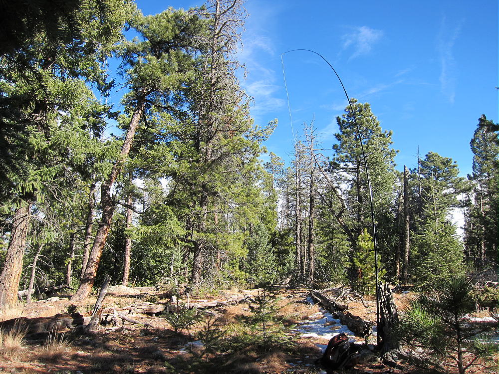
- Evergreen Mountain Activation Setup
-
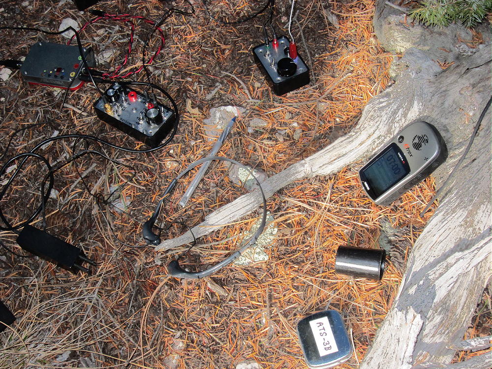
- Evergreen Radio Gear
Since the mountain is surrounded by other peaks in many directions, it’s probably only a fair VHF/UHF site – the view of the Metro area is limited.
-
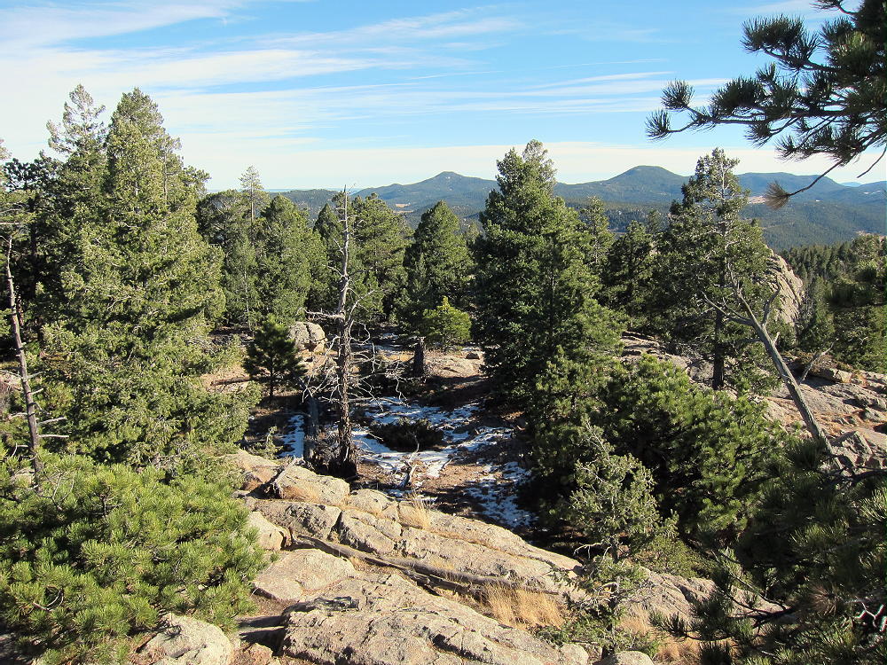
- Evergreen Mountain Summit Area
-
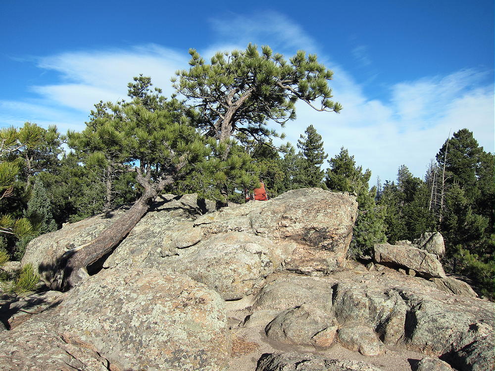
- Evergreen Mountain Summit
-
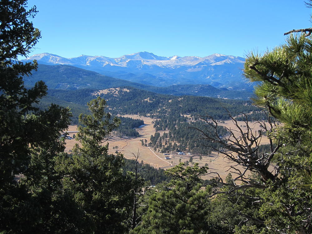
- View West to Mount Evans from Evergreen Mountain
You can return the way you came, or choose another trail to complete a loop back down to the trailhead. Your trip will be scenic via any of the Park trails!
An Evergreen Mountain activation can easily be combined with a family hike, a picnic, a bike ride, or whatever you like.
Evergreen also can be accessed via I-70 west to Evergreen Parkway (Highway 74). This joins Highway 73 at Evergreen Lake.
73
George Carey Fuller
KX0R
![]() !! WARNING !! There are old mountaineers, and
bold mountaineers... there are no old-bold mountaineers.
Hiking and mountain climbing are potentially hazardous activities particularly in Colorado with its extreme elevations. I am not accepting responsibility for any death or injury resulting from activations based on my trip reports. Proper training, experience, and personal capability assessment is required - enjoy!
!! WARNING !! There are old mountaineers, and
bold mountaineers... there are no old-bold mountaineers.
Hiking and mountain climbing are potentially hazardous activities particularly in Colorado with its extreme elevations. I am not accepting responsibility for any death or injury resulting from activations based on my trip reports. Proper training, experience, and personal capability assessment is required - enjoy!