


W0C/PR-019
Bald Mountain
4171 m / 13,684 ft
Sep 19, 2016
By KX0R
Bald Mountain is a challenging, exciting, alpine summit near Boreas Pass, south of Breckenridge.
Key Points:
• White River National Forest
• Challenging high altitude hike
• Marked trail part way
• Ridge route partly on the Continental Divide
• No marked trail to the summit
• Superb alpine scenery
• Excellent HF site
• ~ 6.5 miles round-trip
• ~ 2700 vertical feet total
• SOTA Classic!
-
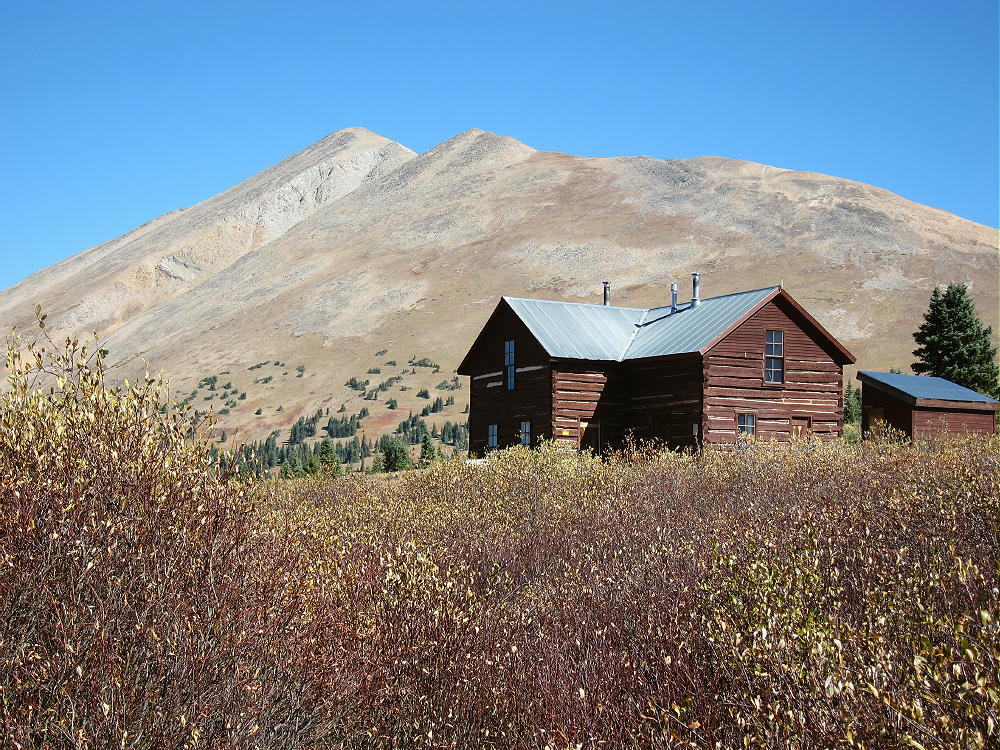
- Bald Mountain and Section House
Driving Directions:
• Drive west on Highway 285 and cross Kenosha Pass
• Continue west on Highway 285 about 10 miles
• Turn north on CR 33 and drive about ½ mile to Como
• Pass through Como and drive up CR 33 about 9 miles to Boreas Pass at 11482 feet
• The route follows a historic narrow gage rail line and continues all the way across to Breckenridge
• CR 33 is an OK unpaved road, with several rough, rocky sections, but most cars can make the trip along the railway roadbed
• Park off the road at Boreas Pass, near the old Section House
• This is the trailhead
The Hike and Climb:
• Google Maps shows none of the hiking trails near Boreas Pass
• You need a detailed topo map to navigate the area
• GPS is very useful up there
• Follow the marked Black Powder Pass Trail as it leads north of the Section House along a water ditch
-
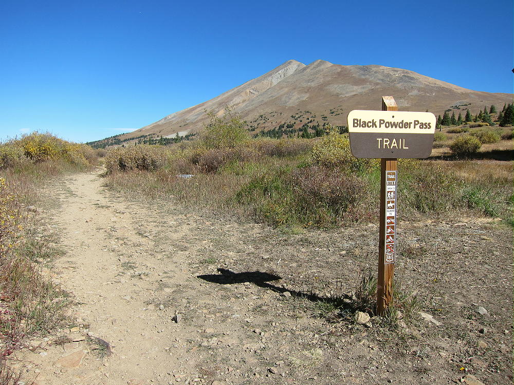
- Bald Mountain – Black Powder Pass Trail
• The pleasant trail heads northeast up a gulch and climbs to Black Powder Pass at about 12,160 feet.
• Leave the trail and climb north up the ridge from the Pass.
-
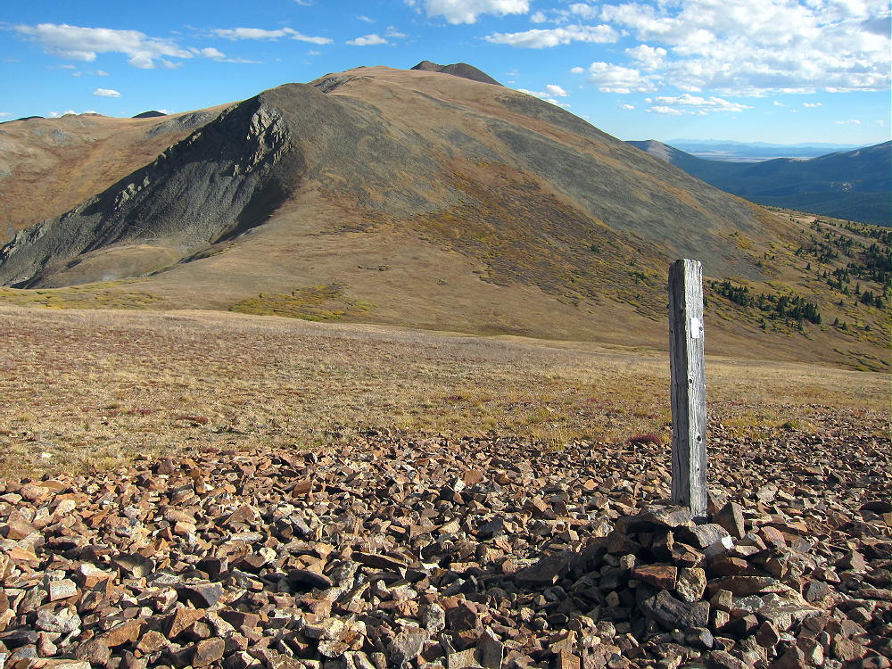
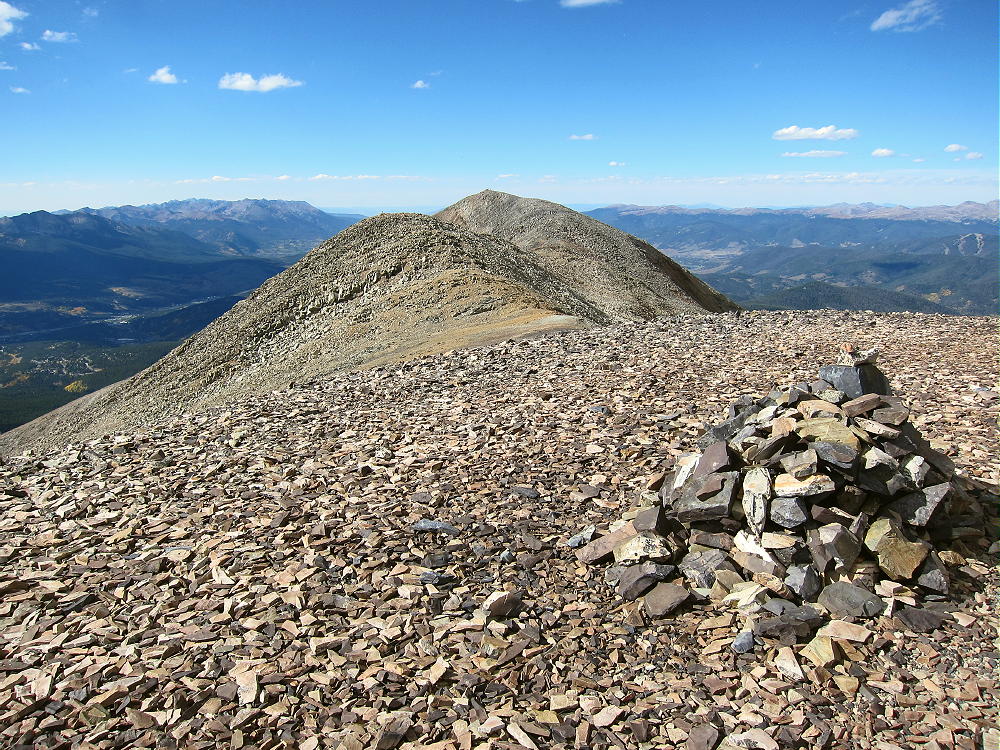
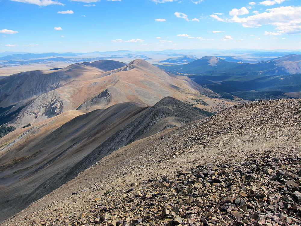
- Bald Mountain Climb – Boreas Mountain and Black Powder Pass
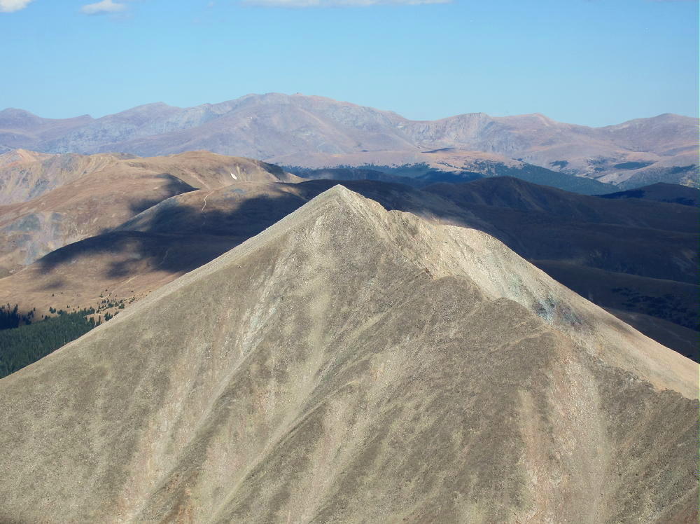
• Continue climbing generally northwest along the rocky ridge for almost 2 miles, across several sub-peaks, and climb up to the alpine summit.
-
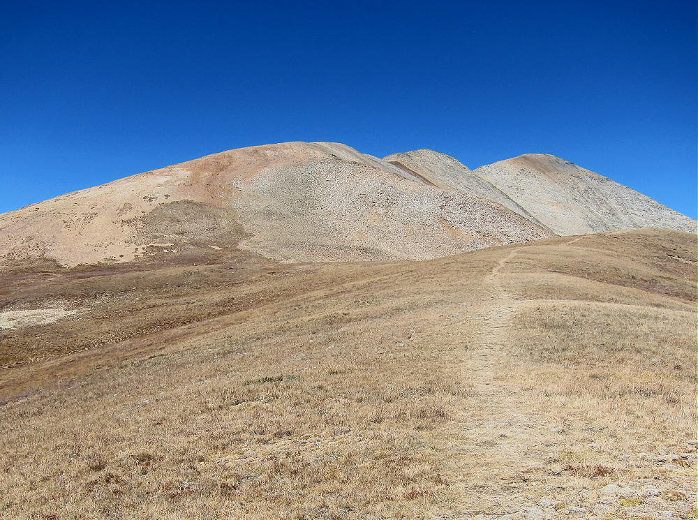
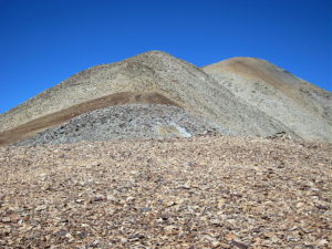
- Bald Mountain Route – South Ridge to South Peak
• The actual SOTA summit is the north peak, but the highest of the southern sub-peaks is almost the same elevation; be sure you traverse the entire rocky ridge and activate the SOTA peak.
-
- Bald Mountain South Summit – Ridge to North Summit
• This is not an easy 13-er with a pleasant trail up through grassy tundra, etc. It’s a serious mountain, and you have to watch your steps and be careful!
Additional Details:
Black Powder Pass is a nice tourist destination, with fine views off both sides. I saw a herd of mountain goats there.
Some route-finding is required along the high ridge to the summit. There are some cairns, and a climbers trail runs along much of the ridge; however, in some spots you may have to ascend talus or climb over boulders to get over the sub-peaks. The entire route need not exceed class 2, but you may find yourself doing a few simple class-3 moves, just because it’s a big mountain with many choices.
-
- Bald Mountain – South Ridge Route
-
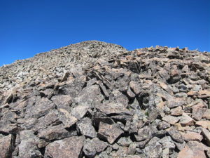
- Bald Mountain – Talus on Ridge Route
Bald Mountain is an excellent 4000+ meter climb! There’s no serious exposure anywhere along the ridge route. The views are continuously awesome! Mount Guyot is particularly impressive less than 2 miles off the northeast side.
-
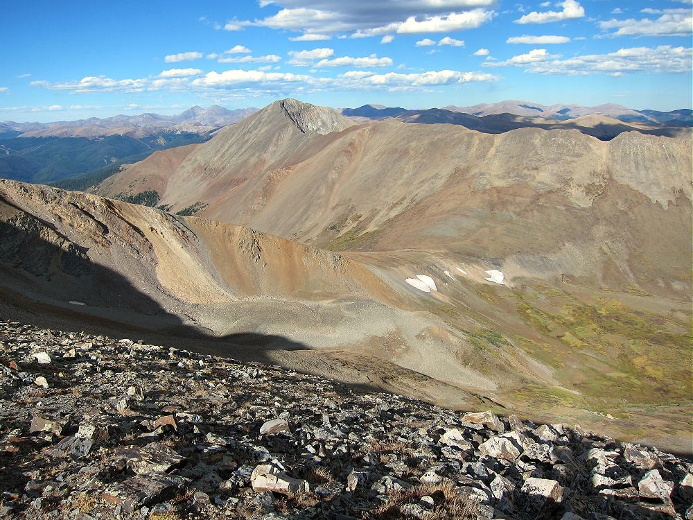
- Bald Mountain – French Pass and Mount Guyot
Boreas Mountain stands high south of Black Powder Pass. Mount Silverheels looms large to the south.
-
- Bald Mountain View South, Boreas Mountain, Little Baldy, and Siverheels
Many 14-ers are visible in the distance – Quandary, Grays, Torreys, etc. Pikes Peak is easy to spot about 60 miles to the southeast! This is real high country in all directions! The summit is a nice climax for the long hike up over so much rock.
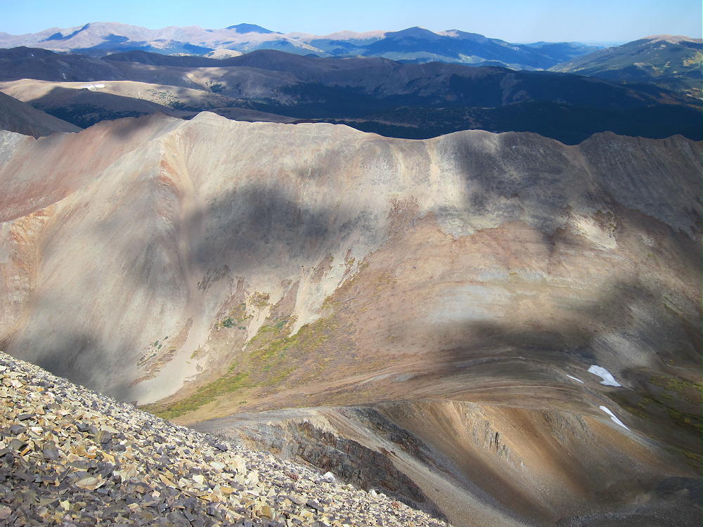
This hike is also a geology field trip. Steeply dipping paleozoic sedimentary multi-colored rock beds appear along the high ridge, over toward Guyot, and in the peaks to the southwest.
-
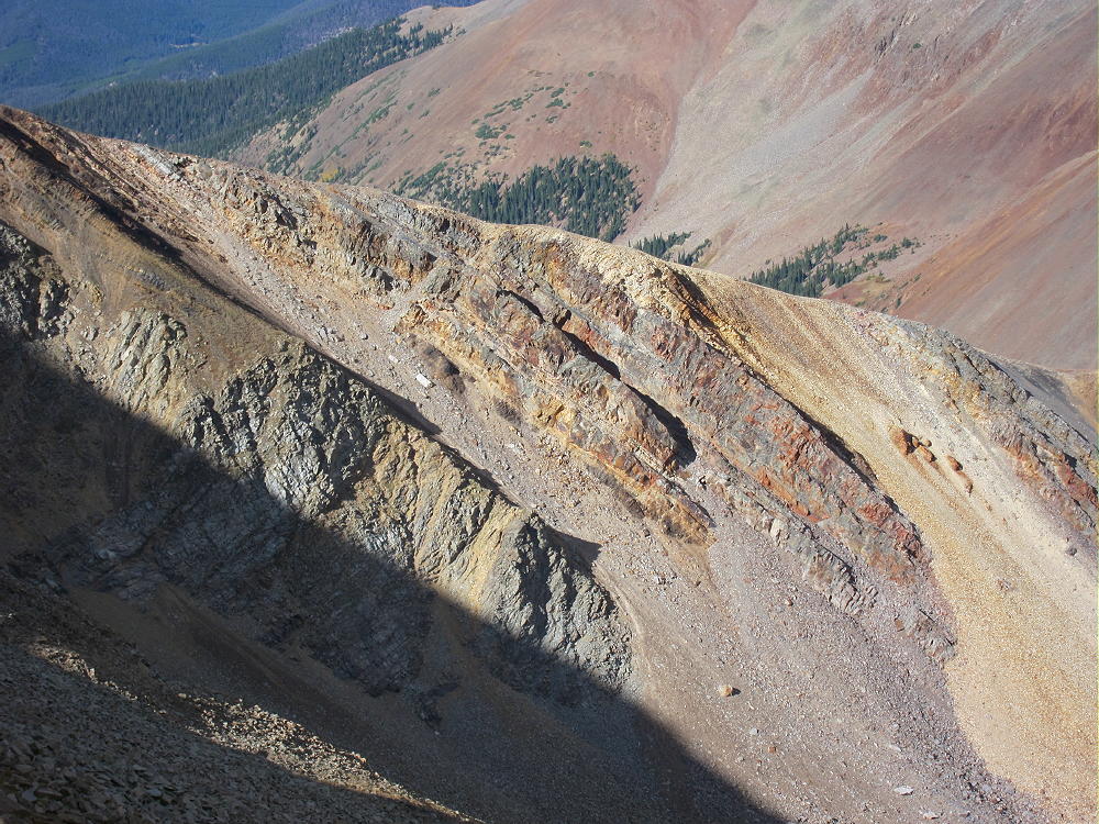
- Bald Mountain – Paleozoic Sedimentary Beds West of French Pass
The summit of Bald Mountain seems to be made of blocky Sawatch quartzite.
-
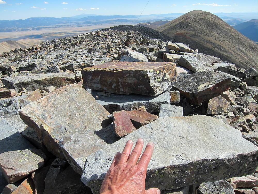
- Bald Mountain – Sawatch Quartzite Blocks on Summit
The historic gold mines of Breckenridge are right down below. Lots of gold is still inside these mountains.
I climbed Bald Mountain on an absolutely perfect day. When I ascended the south summit, I felt like I’d gone up to heaven. Why not, with stunning scenery, warm sunshine, and almost no wind? The north summit was a perfect spot to set up and activate, with a cozy wind shelter right on top! I had an incredibly easy activation, with strong signals, etc. I made 42 CW contacts on three HF bands.
-
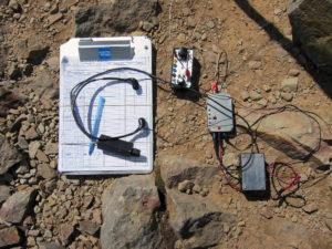
- Bald Mountain Activation Radio Gear
-
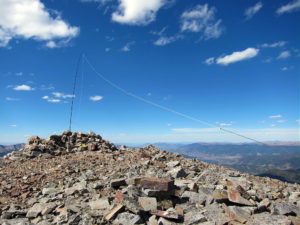
- Bald Mountain Activation
This peak is likely a fair VHF/UHF summit, with coverage across large parts of South Park, the area near Breckenridge, and up north near Lake Dillon.
I had the summit all to myself, although I saw a few other climbers on the ridge. It was so nice I didn’t want to descend and traverse the long ridge back to the south. The longer I stayed up there in the afternoon light, the more beautiful everything became!
-
- Mount Guyot with Mount Evans in the Distance
The return trip over the various sub-peaks takes some time. Each one seems a little higher than it did earlier in the day; it’s a long time at high altitude. It feels really nice to return to the easy trail below Black Powder Pass!
The long alpine ridge of Bald Mountain is a dangerous place in bad weather. In summer an early start is essential. This peak is so nice that it should be saved for a special day when everything is just right.
-
- Bald Mountain East Side – French Pass Sedimentary Rocks
Bald Mountain is totally a SOTA Classic!
There’s a route up Bald Mountain’s northwest ridge from near Breckenridge, but I have no experience with that approach.
For a dual activation, consider these two nearby summits:
Madonna Dome W0C/SP-051 Easy – access from Boreas Pass
Boreas Mountain W0C/SP-030 More challenging – same access
73
George
KX0R
-
- Bald Mountain – Alpine Fall Color
![]() !! WARNING !! There are old mountaineers, and
bold mountaineers... there are no old-bold mountaineers.
Hiking and mountain climbing are potentially hazardous activities particularly in Colorado with its extreme elevations. I am not accepting responsibility for any death or injury resulting from activations based on my trip reports. Proper training, experience, and personal capability assessment is required - enjoy!
!! WARNING !! There are old mountaineers, and
bold mountaineers... there are no old-bold mountaineers.
Hiking and mountain climbing are potentially hazardous activities particularly in Colorado with its extreme elevations. I am not accepting responsibility for any death or injury resulting from activations based on my trip reports. Proper training, experience, and personal capability assessment is required - enjoy!