


W0C/SR-019
Argentine Peak
4179 m / 13738 ft
July 19, 2014
By KX0R
Argentine Peak is a high alpine SOTA peak on the Continental Divide northwest of Guanella Pass. The Peak is close to the Denver area, but a significant hike is required to reach the top. The air is thin, and there is no marked trail part of the way. Awesome views and a fine experience are yours if you activate Argentine on a nice day!
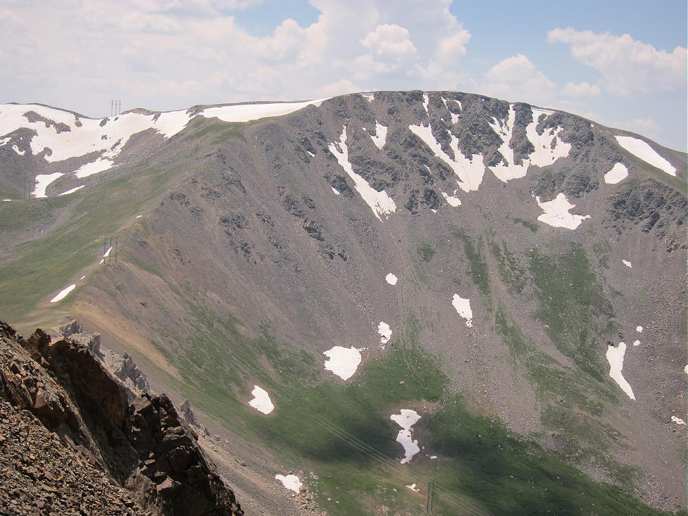
Argentine Peak from Wilcox
Drive up I-70 and exit at Georgetown. Drive through town and follow the signs to Guanella Pass. Drive up the steep, scenic paved highway to Guanella Pass campground at 10,800 feet. Look for a dirt road heading west – Naylor Lake Road. You may be able to drive up this rough 2WD road, depending on your vehicle. Drive or hike up the road about 0.7 miles to the Silver Dollar Lake trailhead at 11,200 feet altitude – there is limited parking. The remainder of the road to Naylor Lake is private.
A good trail leads up about 1.5 miles to Silver Dollar Lake.
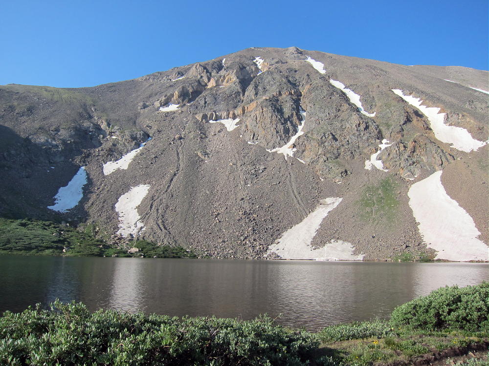
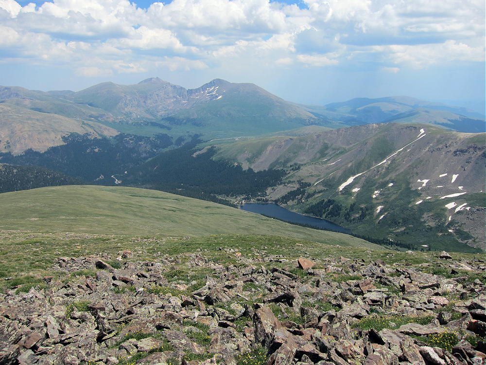
Silver Dollar Lake below Square Top Mountain
The path continues up about ½ mile to Murray Reservoir at 12,150 feet. Before descending to Murray Reservoir, leave the trail at the ridge-top, and head WSW across the tundra. Climb to the 13,000-foot saddle between Square Top Mountain and Argentine Peak.
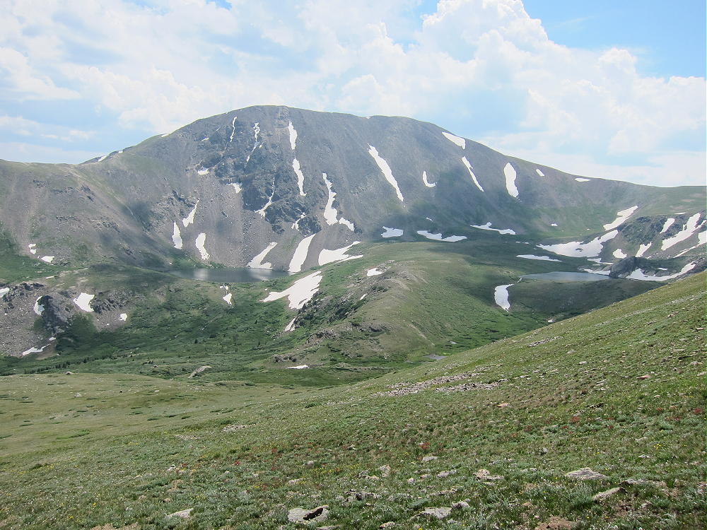
Silver Dollar Lake, Murray Reservoir, and Saddle from Wilcox
Continue climbing NNW along the moderate ridge; some power lines cross the route partway up. The hike is gentle and pleasant close to the top of Argentine.
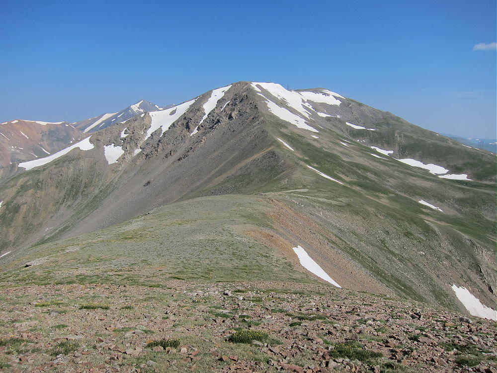
Argentine Peak from South Saddle
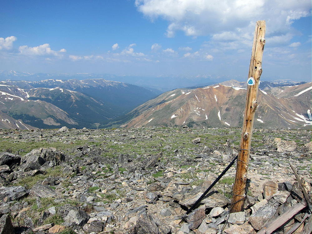
There is a post marking the Continental Divide Trail (CDT) near the summit. The dramatic view of twin 14-ers Grays and Torreys Peaks a few miles to the NW is stunning. 14-ers Mount Evans and Bierstadt stand high to the east. As long as there are no thunderstorms or strong winds, this is spectacular place to set up a pole and activate!
-
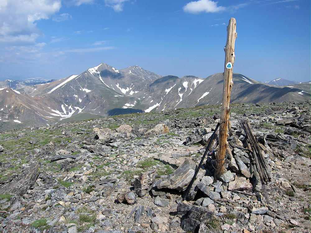
- Summit of Argentine Peak with Grays and Torreys Peaks
-
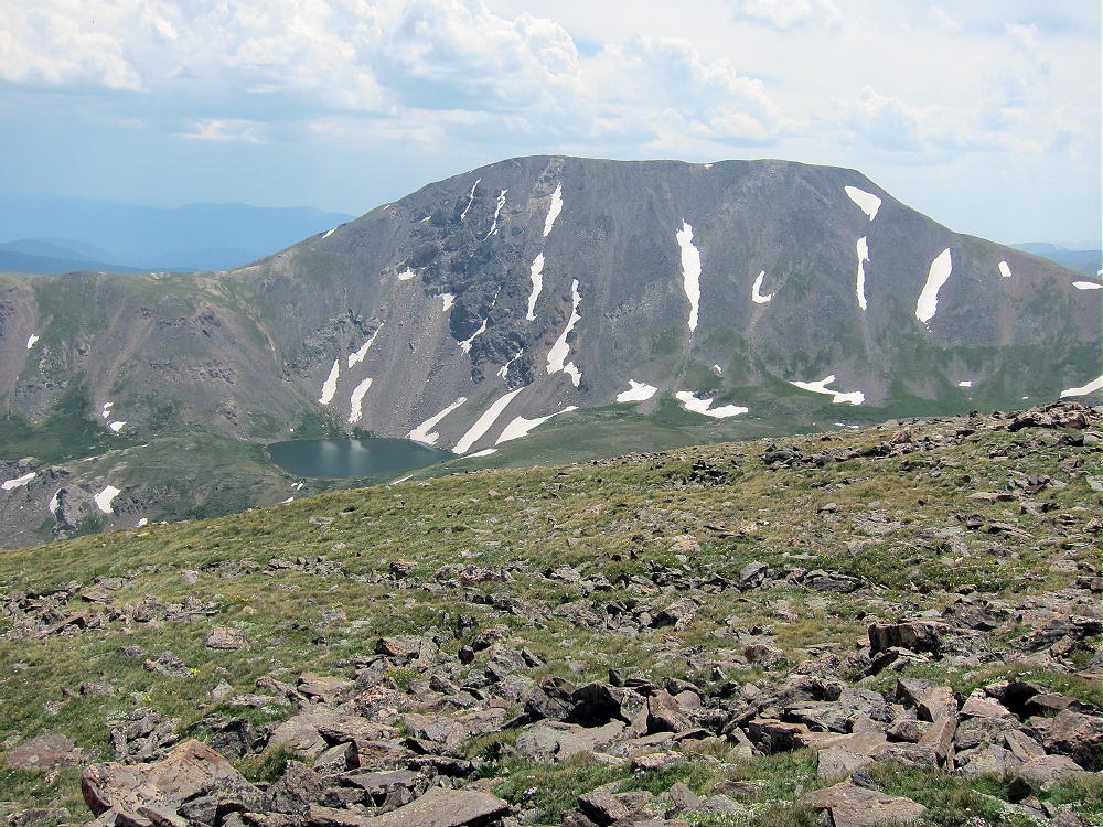
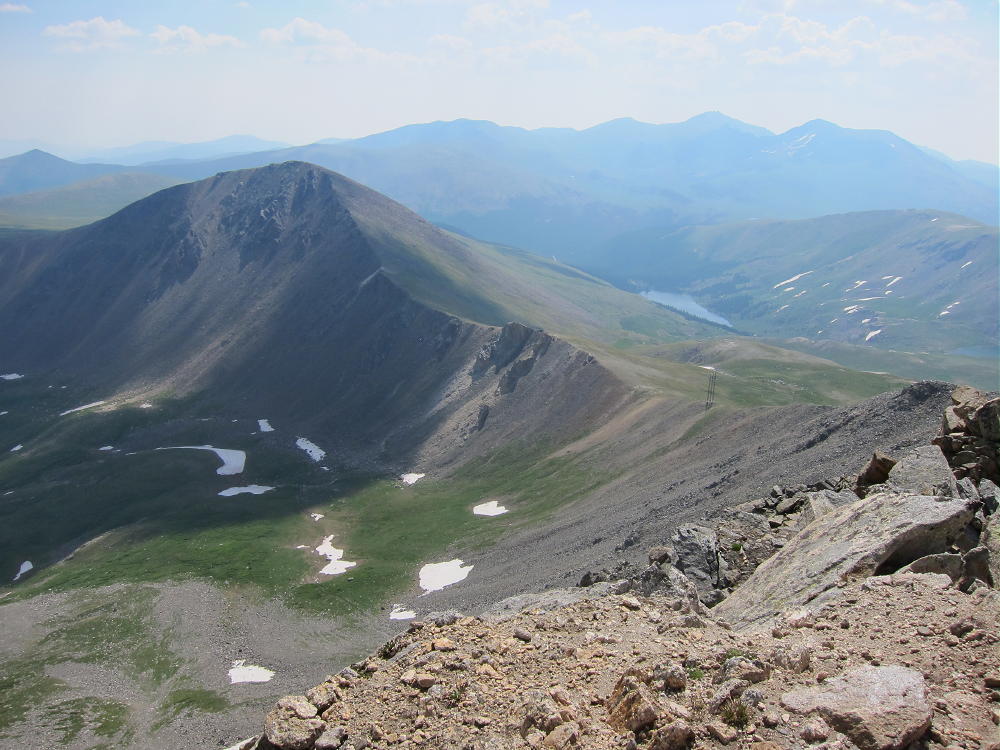
- Square Top Mountain from Mount Wilcox
-
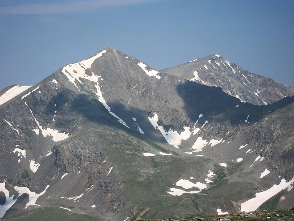
- Grays and Torreys 14-ers from Argentine Peak
-
- Mount Evans, Bierstadt, Guanella Pass from Argentine Peak
-
- Argentine Peak View West
The site is ideal for HF, and it looks OK for VHF/UHF also. I heard no noise from the power lines down the ridge. It was nice to have such a large area of alpine paradise all to myself for so many hours. Argentine Peak is also accessible from Argentine Pass to the north, so you may see people up there.
-

- Argentine Activation 1
-
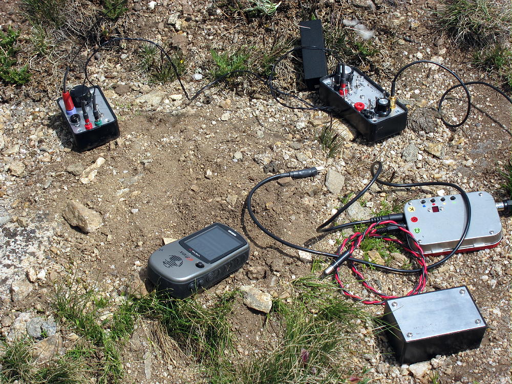
- Argentine Peak Activation Rig
-
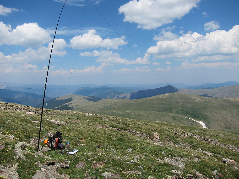
- Argentine Activation 2
It is possible to activate other summits along with Argentine. The day I was there I had good weather, so I went down the east ridge of Argentine to the saddle and then climbed and activated Mount Wilcox – please see the report on W0C/PR-024.
Argentine Peak and East Ridge out to Mount WIlcox
Another alternative is to climb the NW ridge of Square Top W0C/PR-018 from the saddle – there is a path up through the rocks on the ridge – that route is easier than it looks from below.
Square Top and Saddle from Wilcox
Please be careful with respect to the weather up there. Lightning is an obvious danger, but cold, windy, and wet weather are serious hazards as well.
I’ll still remember Argentine as paradise…
73
George Carey Fuller
KX0R
![]() !! WARNING !! There are old mountaineers, and
bold mountaineers... there are no old-bold mountaineers.
Hiking and mountain climbing are potentially hazardous activities particularly in Colorado with its extreme elevations. I am not accepting responsibility for any death or injury resulting from activations based on my trip reports. Proper training, experience, and personal capability assessment is required - enjoy!
!! WARNING !! There are old mountaineers, and
bold mountaineers... there are no old-bold mountaineers.
Hiking and mountain climbing are potentially hazardous activities particularly in Colorado with its extreme elevations. I am not accepting responsibility for any death or injury resulting from activations based on my trip reports. Proper training, experience, and personal capability assessment is required - enjoy!
Pingback: Argentine Pass and Argentine Peak - The KØNR Radio Site
Pingback: Col Argentin et Pic Argentin | Royal Radio club du Borinage